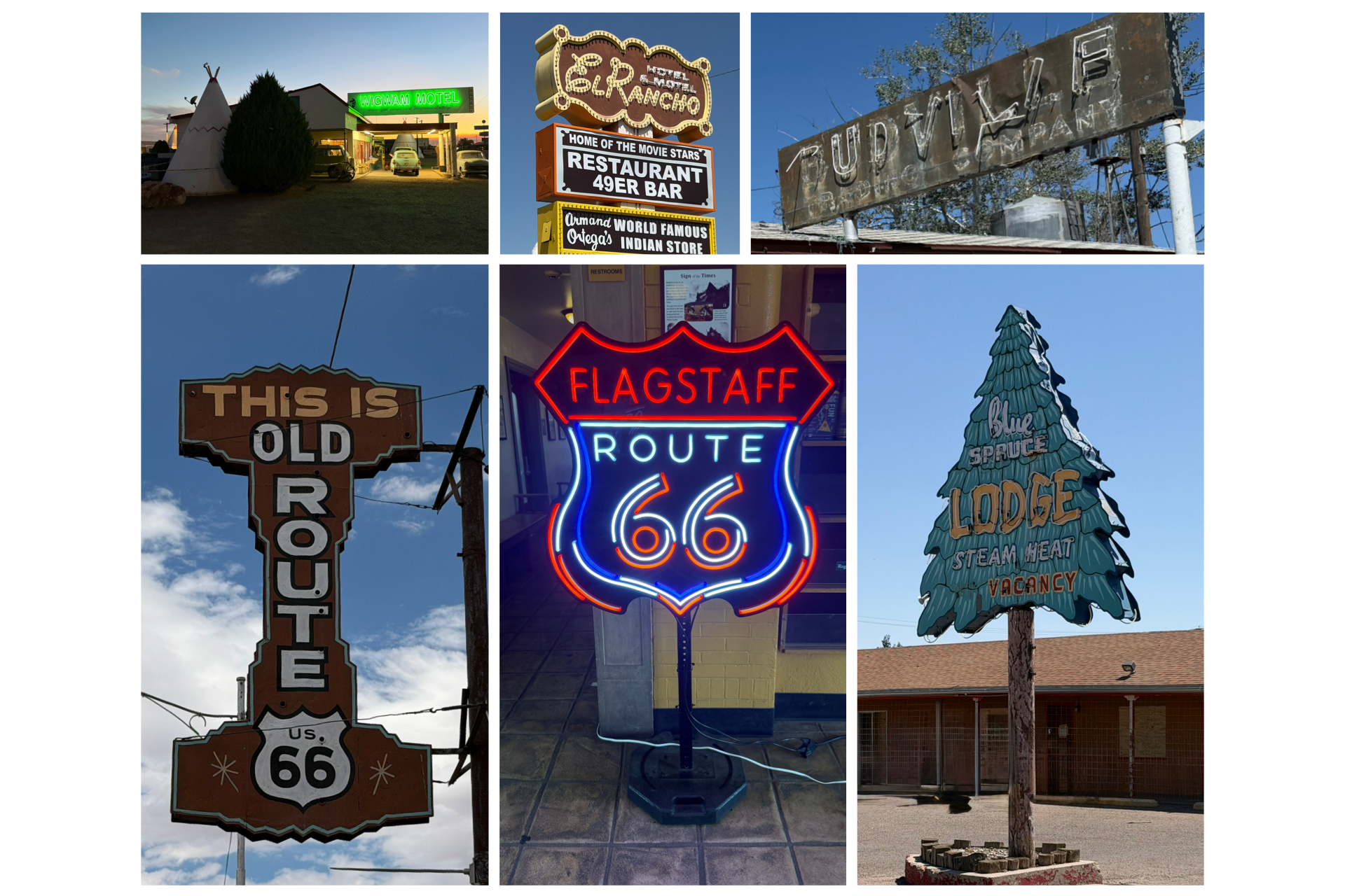
One of the things that absolutely amazes me about many of the historical venues along Rt 66 is the amount of neon signage that was used to advertise their presence. I can only imagine back at its prime just how colorful and lit up the mother road must have been in the evening hours. Truly spectacular I’m sure! This leg of the journey takes me through the rest of Arizona, then into New Mexico. So, let’s get to it!
Winslow, AZ
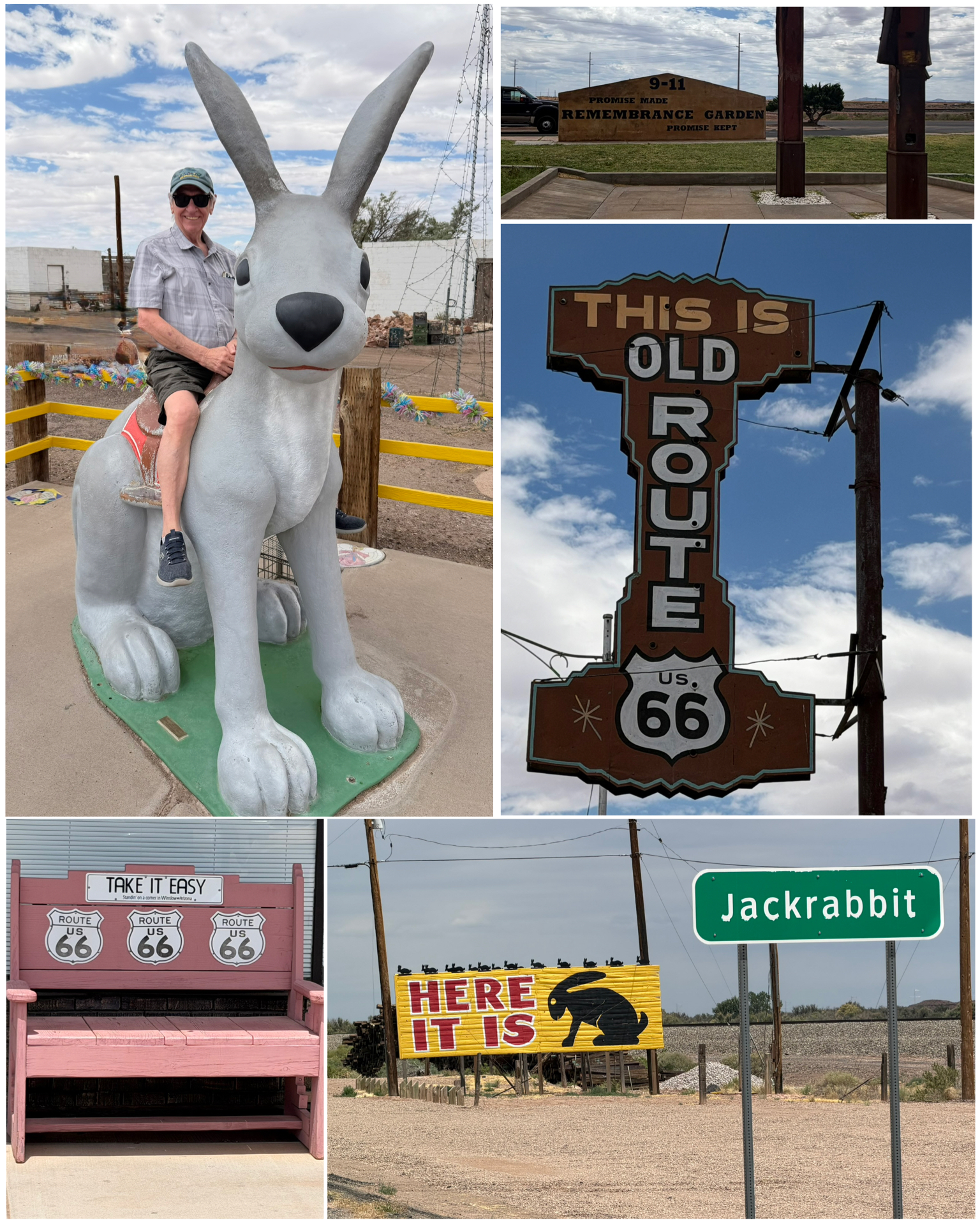 Well, my brother and I begin where we last left off – in and around Winslow, AZ. First up, we checked out the Winslow 9-11 Remembrance Garden (at left, top right), complete with a pair of rescued steel girders from the World Trade Center towers. Winslow was quick to obtain these artifacts and to create this garden – with the dedication occurring on Sep 11, 2002 – at the one year anniversary. Next to the memorial garden was a stretch of road with a specialized rumble strip that when driven over at the posted 35 mph, plays a fragment of the Eagles Take it Easy song. We drove over it several times in the course of our travels in and out of Winslow. Lots of fun! Just down the road is this Old Rt 66 sign (at left, center right) that once advertised some sort of business here on 66. However, whatever that business was, it was long gone. Instead, the owner had it painted and all the neon fixed and made a generic “Old Route 66” sign out of it. Nicely done! We had a bit of time to kill, so we headed out to nearby Joseph City – about 15 miles back towards the east, to visit Jackrabbit Trading Post. Opened in 1949, the owner came up with the idea of putting up billboard signs at various points along Rt 66, indicating how many miles it is to Jackrabbit. Similar to what we see heading to Pedro South of the Boarder on I-95, or Wall Drug off of I-90, or even The Thing off of I-10. Anyway, when you finally arrive, you get to the Here It Is sign – perfect for a photo op. Besides all the standard fare trading post trinkets and souvenirs, there was also this giant rabbit outside that was perfect to hop on for
 a photo. Somehow, I convinced my much more senior brother to hop on so I could take his picture. What a good sport! I got away without buying anything, but my brother Dick found a clearance section on state plates selling for $1, and while the state choices were slim, there just so happened to be one remaining plate for the state of New Hampshire. I sure hope it makes its way back home safely!
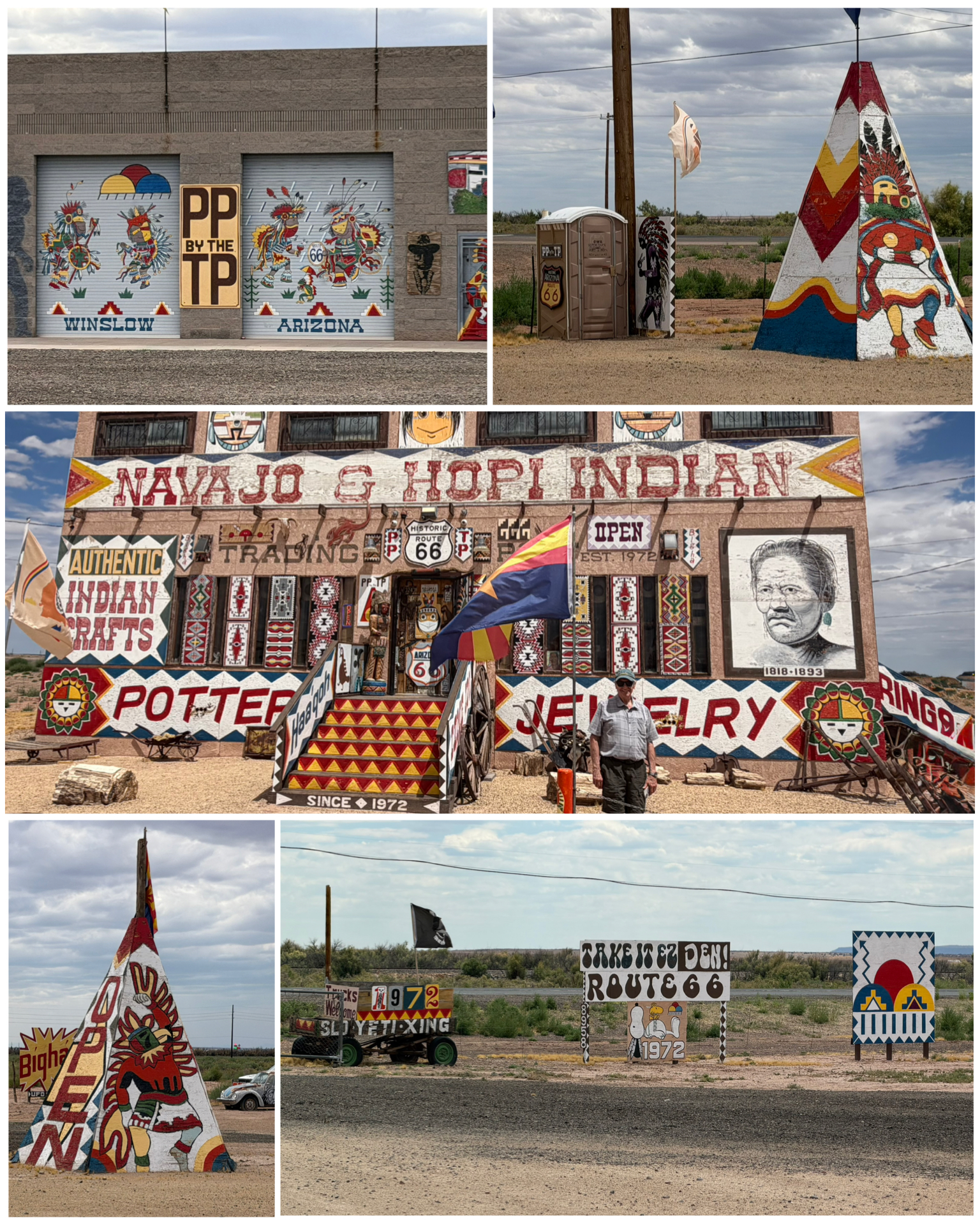
The reason we had to kill some time is that our plans in Winslow included spending the night in the historic hotel known as La Posada, and we needed to get closer to mid afternoon check in. So, on the way back to Winslow from Jackrabbit, we also stopped at another trading post with the catchy phrase “PP by the TP”. Which as you can see in the picture at right top right, represents an outhouse sitting next to a teepee. Nice way to get visitors! But it was your typical tourist trap gift shop with lots of interesting and colorful signs and artifacts to make the stop worthwhile. My brother and I also enjoyed chatting with the gift shop proprietor who was well versed in area history. A cool and interesting stop.
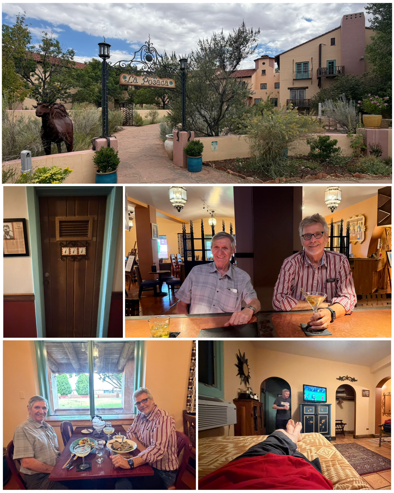 So, we made it back to Winslow mid afternoon, and got ourselves checked into La Posada. This hotel sits alongside the Winslow train depot to one side, and faces Rt 66 on the other, and catered to travelers from both sources. This hotel was built in 1930, and was one of the final and said to be the crown jewel Harvey Houses ever built. Its design is a combination of Mission Revival and Spanish Colonial Revival, with much of the design and decor coming from Mary Colter – an 1890s graduate of the California School of Design, renowned architect and designer, and longtime design partner with the Fred Harvey Company. She considered La Posada to be her personal masterpiece, curating everything from the building structure to the furniture and even the landscaping. The hotel thrived for the better part of 27 years, but as both passenger rail and Rt 66 traffic lessoned, the hotel was closed in 1957. Its museum quality contents were auctioned off, and its interior was gutted to transform the building into railroad offices. It was soon thereafter abandoned, and over the next 4 decades, narrowly escaped demolition multiple times. Fortunately, developer and historic restoration specialist Allan Affeldt became interested in the property and he and his partners purchased it in 1997 and after many years of restoration,
 substantially restored and reopened the historic hotel and restaurant into a living museum. The Turquoise Room, the hotel’s restaurant, was even rated among the top 3 restaurants in the country by Conde Naste in 2009. After a brief rest after checkin, we headed down to the bar for a before dinner drink, then enjoyed a fabulous meal thereafter. After dinner it was back to the room to relax and watch some World Cup action. What an amazing stay in an amazing hotel!
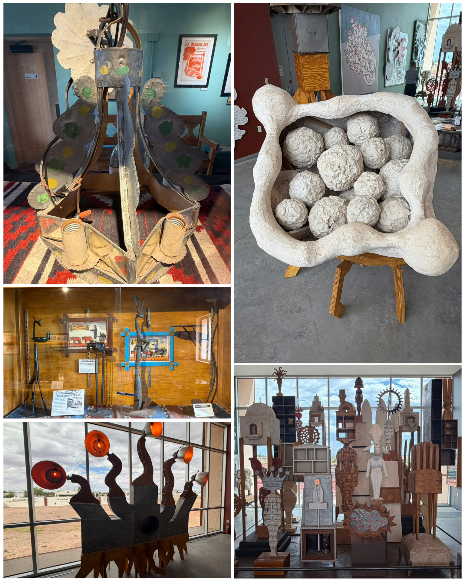
Part of the restoration also included a museum that featured lots of Fred Harvey and Mary Colter history. You can see Mary’s chandelier designs (at right, top left), as well as several of her very cool looking ash trays stands (at right, center left). There was also another artist featured in the museum by the name of Dan Lutzick. To say his art is a bit quirky would be an understatement. I guess its one of those “art is in the eyes of the beholder” kind of things. But my eyes were not necessarily beholding the art he was giving. Oh well!
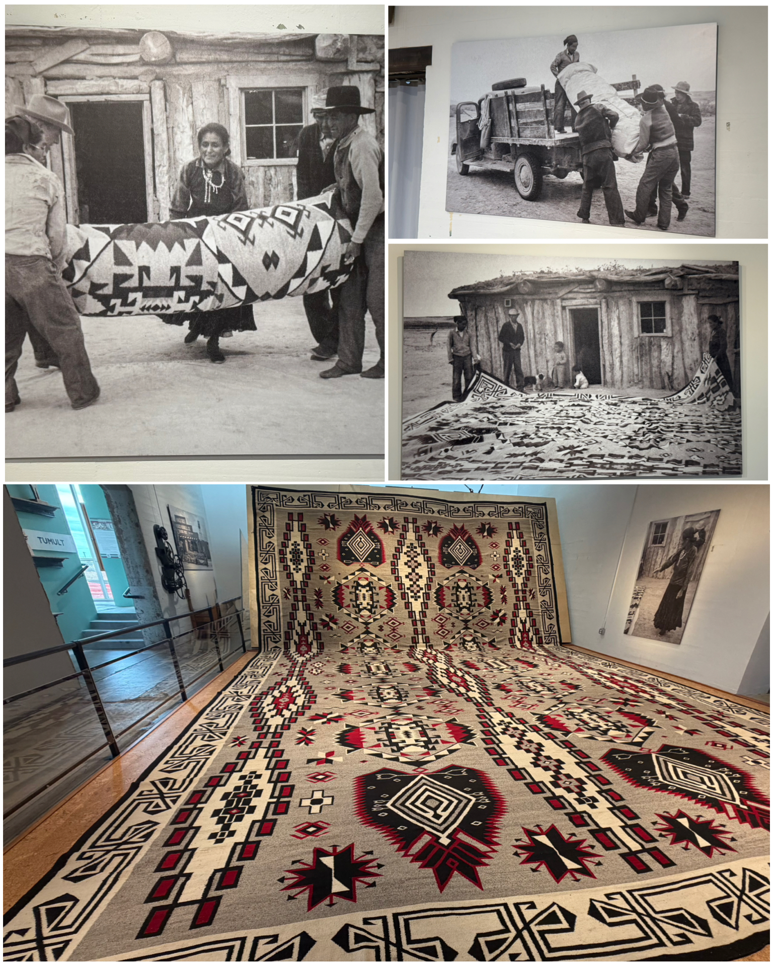 Another part of the museum featured this amazing piece – the world’s largest Navajo rug. In 1932, master weaver Julia Buh Joe and daughter Little Joe Hill were commissioned by Lorenzo Hubbell Jr. to create this amazing rug. Hubbell was owner of a Winslow trading post at the time, and was looking for something he could add to draw in the crowds. The Joe family would spend the next five years creating this behemoth known in Navajo as Diyogi Tsoh – meaning Big Rug. A picture of the little shack in which the rug was created, along with it being prepped and transported are featured at left. The final product, at 21 by 33 feet, was a masterpiece of scale and exceptionally intricate technique that highlights the artistry of Navajo weaving. It remained in the trading post until its bankruptcy in 1949, then a new owner handled exhibiting it – even making an appearance at the 1964-65 New York World’s Fair. The rug remained in the public eye until the final trading post closed in 1970, after which the rug went into storage for several decades. In 2023, it returned to public view in this purpose built multi-million dollar gallery space here in La Posada. Truly an amazing piece of art and history!
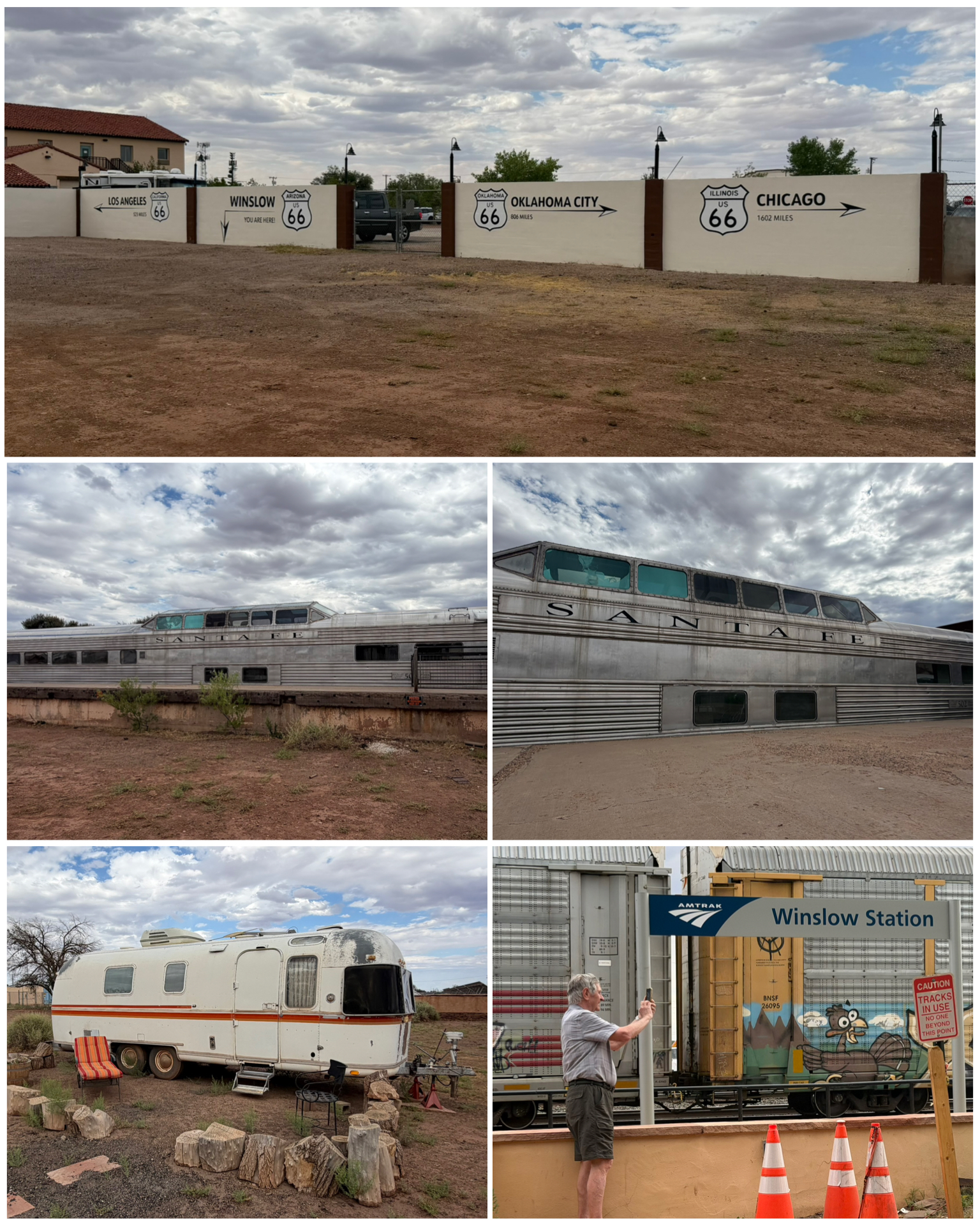 In the rear of the hotel are the train tracks that along with lots and lots of commercial product transport, also includes an Amtrak stopping station. So even today, folks can take a passenger train ride and stop to stay here at this magnificent hotel. A few other future projects are here in the back including the future restoration of this classic and very rare Santa Fe Super Chief Pleasure Dome #502 (at right, center) into the Turquoise Room Lounge Car. Planning and fund raising is currently underway for this project. Another relic of history that was sitting in the back lot of the hotel was this Airstream Argosy (at right, bottom left). It was setup seemigly ready for someone to jump in and start camping, but its true purpose and plan in life are unfortunately unknown. Maybe a future rental option to spend the night. But whatever it becomes, it was a cool piece! Lastly, there were some cool Rt 66 map panels painted on some dividing walls in the far back that showed the relative distance of the start, middle, and end of Rt 66. Clearly, I’ve still got a long ways to go!
Grants, NM
After an a full week of playing tourist in the Holbrook, Winslow, and surrounding area, it was time to move to the east further along down the Rt 66 corridor. Our next planned RV stopover takes us to Grants, NM – some 150+ miles down. Here we would stay for roughly a week to explore the towns of Grants, Gallop, and several little byways and places of interest in the area. It was a smooth and mostly uneventful trip down I-40 to our new location, and we made quick time of getting there and getting setup with the traveling home on wheels.
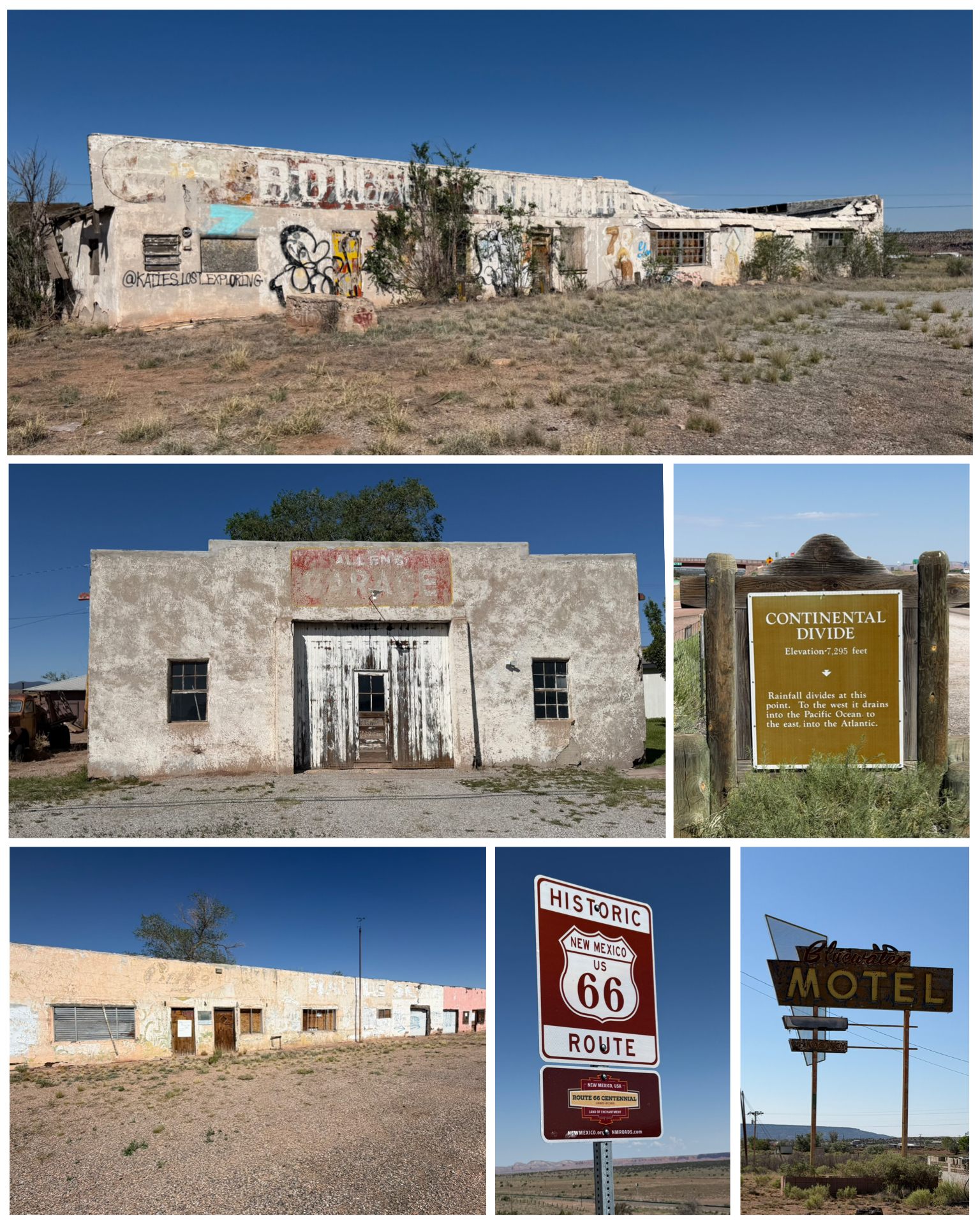 Our first day of playing tourist takes us back to the west towards Gallop. We hopped on the old Rt 66 heading in that direction, and in-route, came across several former Rt 66 destinations that today are mere remnants of their formal selves. Bluewater Motel (at left, bottom right) in Bluewater, NM is one of those former glories. What remains now is a dilapidated building, and an aging and likely non-functional neon sign. But, the sign was very cool! A little bit further down the road was what likely had been a busy Rt 66 vehicle repair station. Allen’s Garage (at left, center left) was opened by Allen Payne in 1955 soon after his return from the US Navy and WW II. He apparently also had a passion for farming, and after purchasing some farmland nearby, he would work the farm in the morning and evening, and the garage during mid-day. That obviously became too much, and he eventually closed the garage to work farming full time – and did so through his mid 70s. That’s quite the work ethic! Next were the remains of what was a 1954 business (at left, top) known a Bowlin’s Old Crater Trading Post.
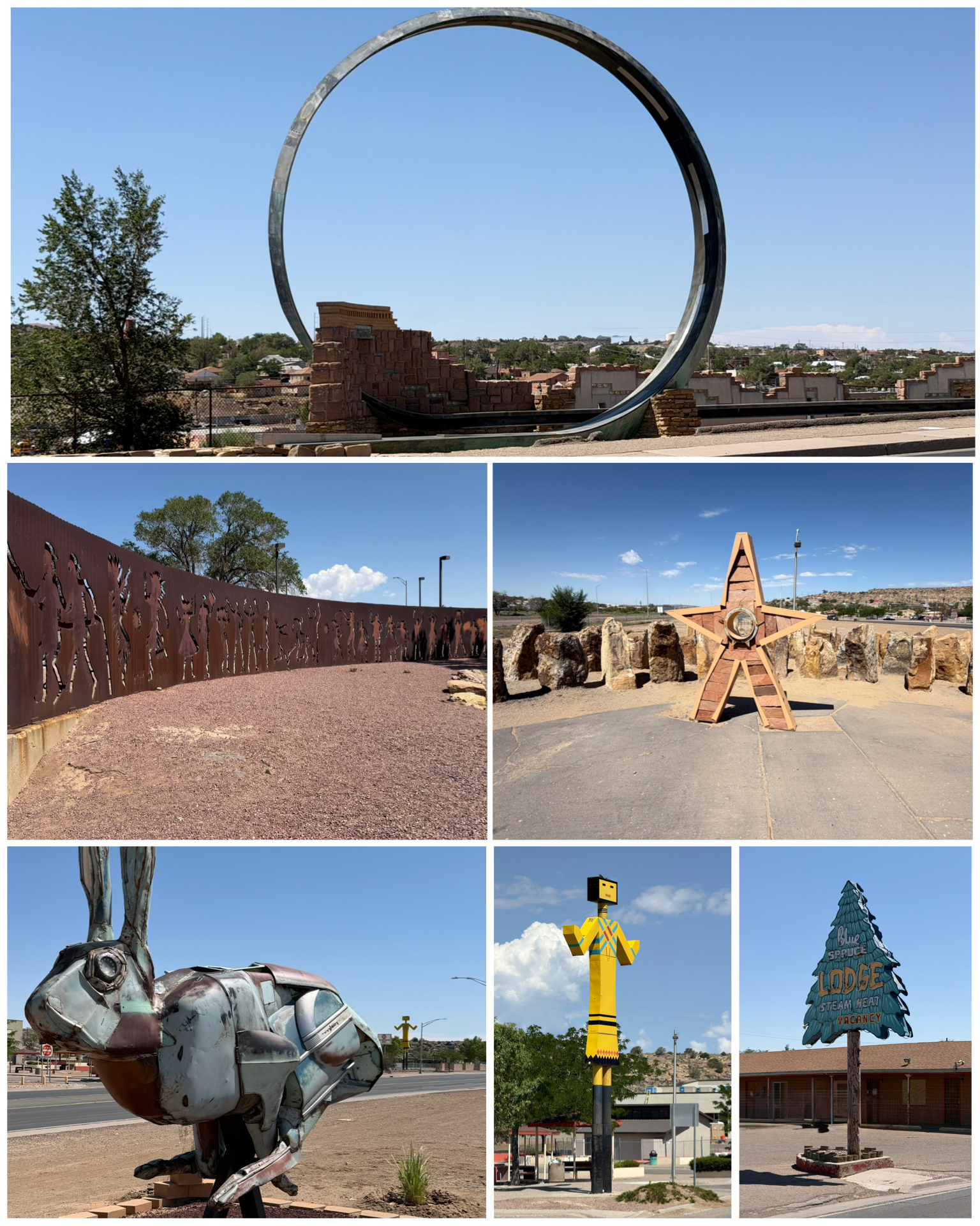 We continued west until we reached the town of Gallup. There, we would find not only a bunch of historic Rt 66 treasures, but also several Roadside America items of interest. A visit to “We the People Park” would showcase several Roadside items. First up, the Chevy Jackrabbit was created by artist Robert Wilson and was just unveiled in Mar 2026. It is made of cutup 1953 Chevy Bel Air parts that were then welded together to form this running bunny. It’s said to reflect the towns local wildlife, along with cars speeding down Rt 66. Fun fact – the left eye of the jackrabbit is made from the Bel Air’s speedometer, which has been permanently set to 66 mph. Also in the park were a series of other interesting artscapes including a rock concert (at right, center right), and a long steel wall with cutouts that had been placed slightly offset to create a sort of 3D and light capturing effect. Way cool! Across the street from the park was this Indian Kachina Statue (at right, bottom center). This 30-foot tall spiritual Hopi greets travelers to Gallup. A version of this Kachina once stood on Rt 66 since the late 1940s. Just down the road is the Gallup Loop – or as it has become known as locally, Galoop. This public sculpture was created by Charles Mallery and Robert Hymer who titled it “Paso por Aqui” – meaning “passed through here”, was meant to symbolize all the varied people who had passed through Gallup in its history. Locals however, didn’t buy it, and instead thought the 30-foot tall structure looked more like a Hot Wheels track loop which garnered its Hot Wheels Track and Galoop nicknames – the latter of which stuck. Now back on the actual Rt 66, we arrived at one of several historic rest stops – this one the Blue Spruce Lodge (at right, bottom right). This was one of three “U” shaped motels all next to each other, that were built between 1949 – 1952, each featuring an iconic light-up sign to attract Rt 66 travelers. While the signs remain popular photo subjects, all three motels were closed in 2021 by city inspectors.
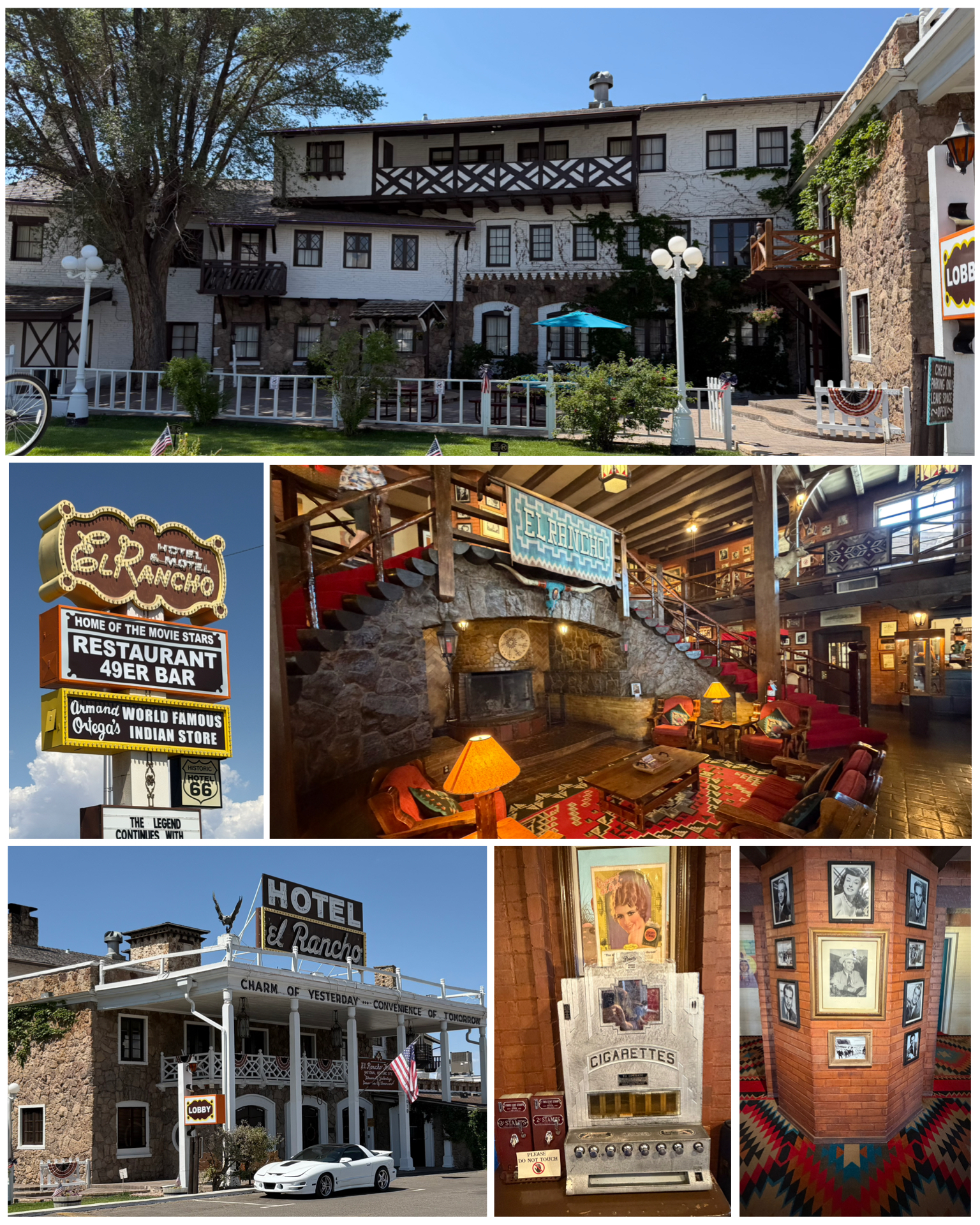 The next stop in Gallup takes us to the 1937 El Rancho – known as the Home of the Movie Stars! The hotel is known for its amazing hunting lodge lobby (at left, center right), and for its guest rooms named after the actors who reportedly once slept in them. The lobby and upstairs area are filled with photos of pretty much every Hollywood who’s who from back in the day. Ronald Reagan, Kirk Douglas, Humphrey Bogart, Spencer Tracy, Katherine Hepburn, and John Wayne, just to name a few. Outside above the entrance in bright neon lights is the phrase “Charm of Yesterday – Convenience of Tomorrow”. Lots of historical artifacts filled the lobby including this antique cigerette machine (at left, bottom center). This was truly a magnificent hotel, and has been added to my list of cool places to stay if the opportunity presents itself in the future.
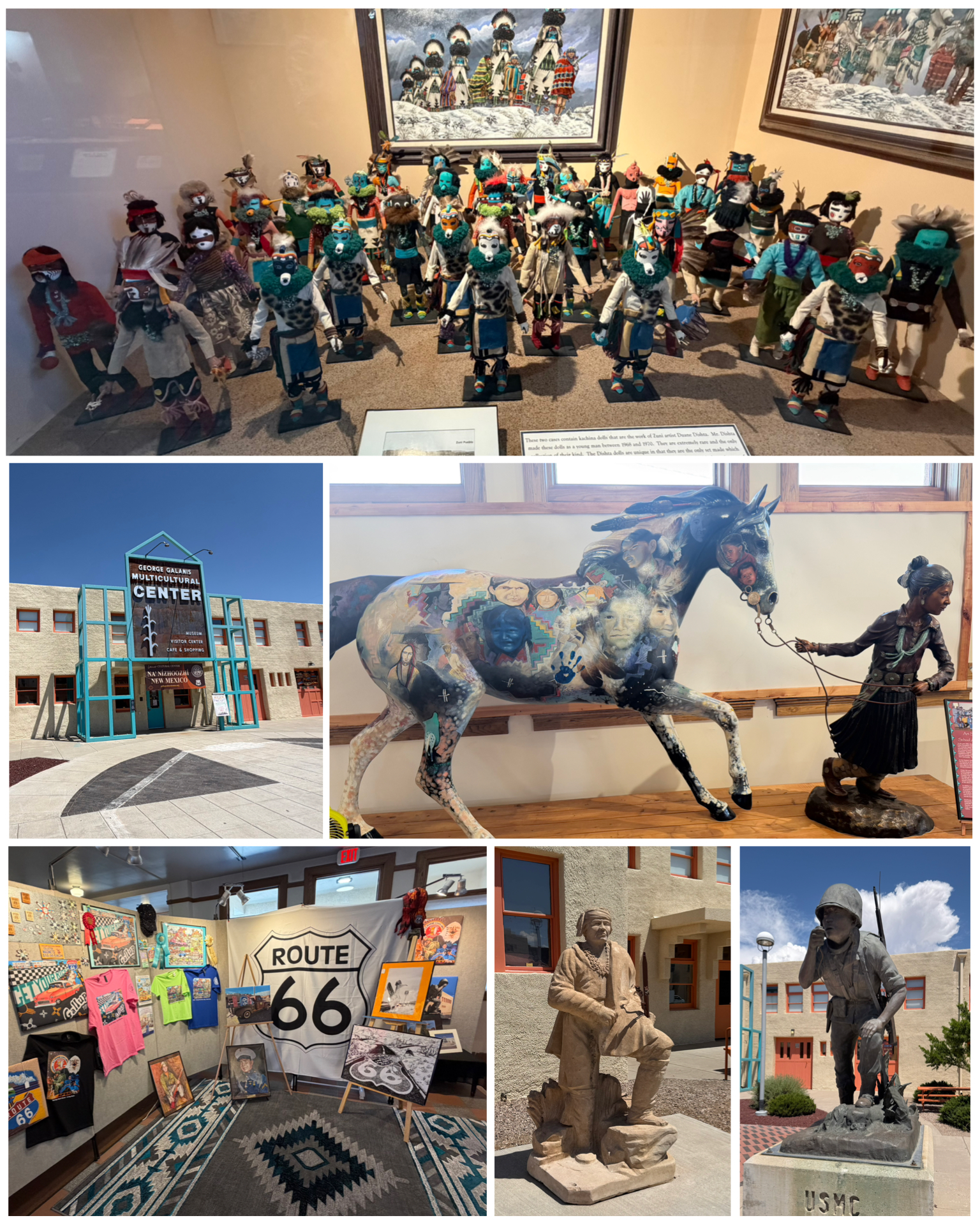 Next we visited downtown Gallup and its several interesting stops. First up was a visit to the Gallup Cultural Center. What was once the elegant 1923 El Navajo, a Fred Harvey railway station hotel, was bulldozed in 1957 to support the Rt 66 widening project. Upon the hotel’s ruins, this cultural center was built, and features the Storyteller Museum, Master’s Gallery, Route 66 Theater, and Edward S. Curtis Exclusive Collection – offering a unique glimpse into the history of the Southwest. It was a beautifully done cultural center with lots of exhibits and artifacts. There was an entire section dedicated to the Native Americans who became specialized US Marines known as Code Talkers. My brother Dick had heard of that group before, but I had not. A code talker was a person employed by the military during wartime to use a little-known language as a means of secret communication. In this case, it was WW II, and it would be codes formally developed based on the languages of the Comanche, Hopi, Meskwaki, and Navajo peoples. They used words from their languages for each letter of the English alphabet where messages could be encoded and decoded by using a simple substitution cipher where the ciphertext was the Native language word. Service records suggest there were 642 Code Talker who were part of the US military. Today, the term code talker is strongly associated with the bilingual Navajo speakers trained in the Navajo Code during World War II by the US
 Marine Corps. This was a fascinating piece of war history that I was not aware of. When we got back to the RV after touring Gallup, I searched and found an hour long video on YouTube that provided an interesting history of this specialized group of Native Americans. You can watch that video HERE. A shorter, brief overview of the code talkers can be found HERE.
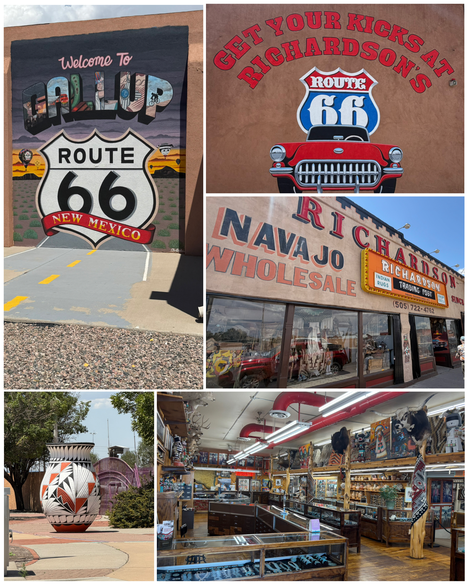
We continued our tour of downtown Gallup, first visiting the Gallup Visitor Center (at left, top). Here I got my Rt 66 travel book stamped, and we picked up a few brochures to help us in our travels. Next we walked down the street to Richardson Trading Company. This upscale trading post has been in continuous operation since 1913 – even longer than Rt 66 existed. It features hand-tooled leather saddles, shotguns with intricate inlays, and lots of turquoise jewelry and hand-made baskets and rugs. However, you had better have really deep pockets to get a souvenir from this place as everything is very high end! There was also lots of various art pieces throughout town, including this really nice giant pot (at left, bottom left). It had to be 6 feet tall!
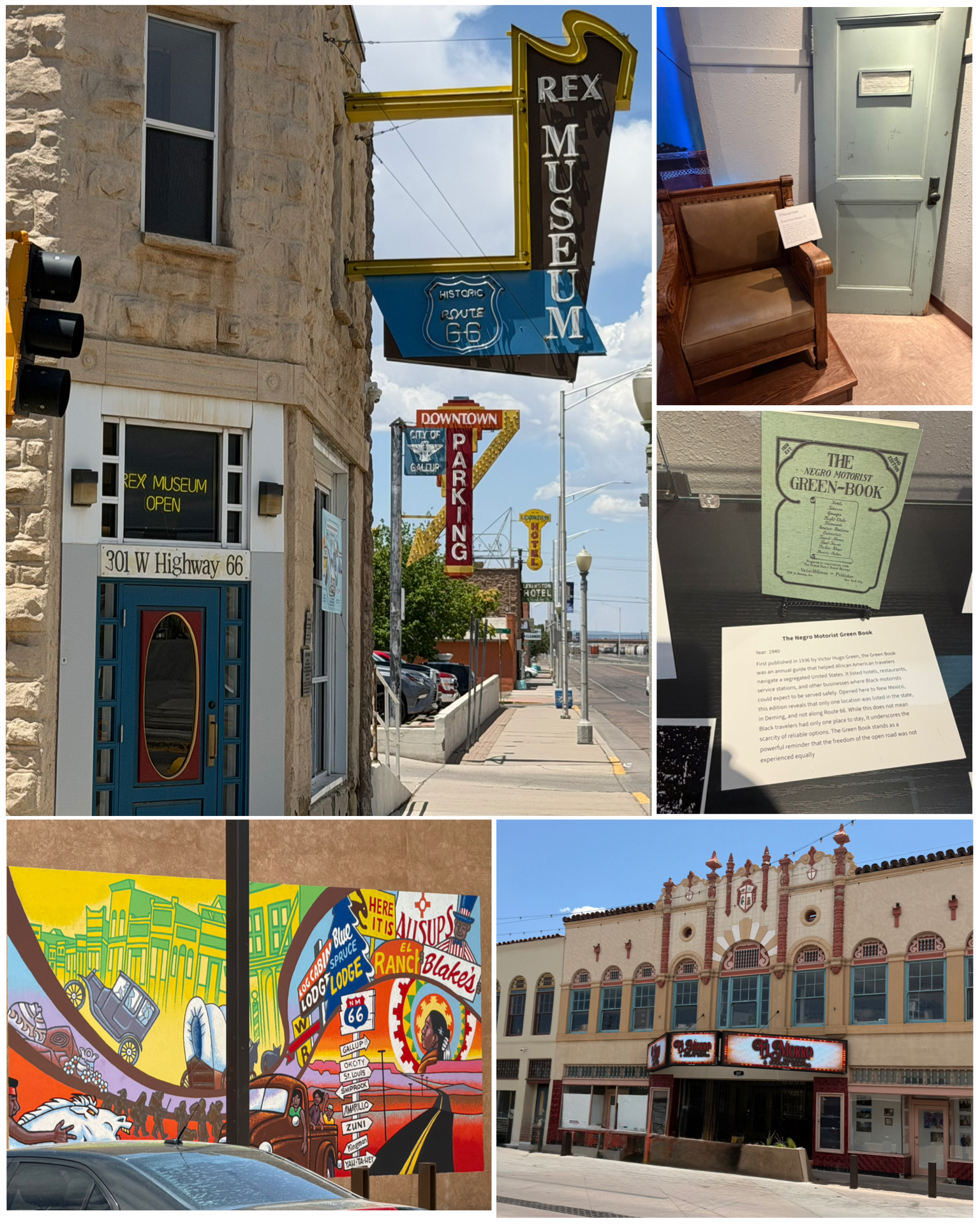 We wrapped up our afternoon in Gallup with these final couple of places to visit. One of which was actually a pop-up Rt 66 museum that wasn’t even on any of my lists of places to visit. It was located in the former Rex Hotel (at right, top left) and was setup specifically to celebrate the Rt 66 centennial. It had lots of interesting historical artifacts including a chair and the door from Room #71 saved from the El Navajo Hotel. Also in the museum was this 1940 book titled The Negro Motorist Green Book. This guide helped by providing lists of hotels, restaurants, service stations, and other businesses that would be safe and accommodating to Black motorists. Sadly, only one location in the entire state of NM was listed in this edition, and it was not along any part of Rt 66. Wow – as noted on the accompanying information card, “clearly a powerful reminder that the freedom of the open road was not experienced equally”. There were also some nice murals in town – an example of which is shown here at right. Last up, we checked out the El Morro Theatre which opened in 1928, and is known to be the “castle of pleasure and art” and features the architectural style of Spanish Colonial. It is one of the few remaining Rt 66 theaters still showing first-run movies. Back in the day, it even included a cry room where mothers could take their uncooperative infants, while continuing to watch the movie through the room’s included window. Definitely a beautifully maintained historic Rt 66 building.
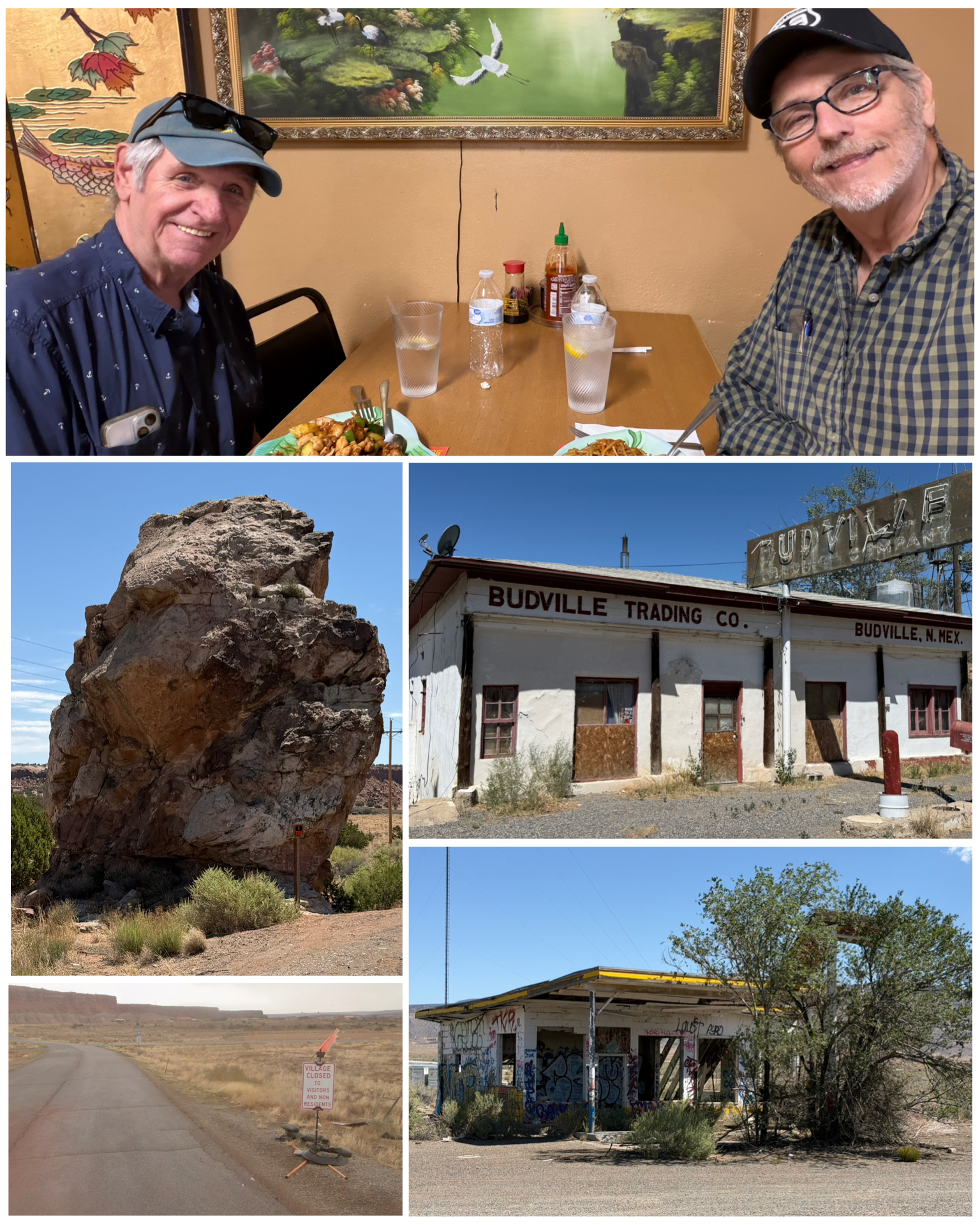 The next day, we ventured out to the east along old Rt 66 travelling out to about the 40 mile mark to check out more historical treasures. First up just west of the village of San Fidel were the remnants of what was once Whiting Brothers Gas Station (at left, bottom right). A chain of gasoline stations established in 1926 that at its peak, operated more than a hundred filling stations – including at least forty on the former Rt 66. Few remain today, and this one here certainly has seen better days. Next, we headed to the town of Budville, NM where we find what remains of the former Trading Post (at left, center right). My brother did an excellent job describing this place and its history on his Facebook post, so I’m just going to “borrow” it, and republish it here. “Today we drove east on old Route 66 and saw some of the old now abandoned buildings. Probably the most famous or maybe infamous one was Budville or what some call Bloodville. Roscoe Rice started a business fixing cars on what became Route 66. He was quite an entrepreneur. However his son Howard “Bud” Rice took it a lot further. He built an empire with businesses involved in towing, repair, general store and trading post. He apparently named the town Budville after himself. He prospered during the Rt 66 days and even when I-40 was built he arranged to get an exit built to his town. It was going great until 18 Nov 1967 when a man stopped for gas and went into the store to rob it. Bud walked in and the man shot and killed Bud and the clerk, an 82 year old woman. Bud’s wife Flossie walked in and she was tied up and gagged and the man walked out with $450. Flossie’s second husband was also shot in a robbery attempt but survived only to be killed in a brawl in 1973. Budville never recovered from the murders and finally turned into a ghost town in 1979.” Thanks Dick for writing this part of my blog! Our last stop on this adventure took us to what was called “Owl Rock” (at left, center left). I’m not sure how much alcohol has to be consumed prior to seeing that this rock resembles an owl, but clearly neither my brother or I could see it. Oh well! As we wrapped up riding along the old Rt 66 heading back towards I-40 to get back to Grants, we came across this intersection that had the sign (at left, bottom left) that read: “Village Closed to Visitors and Non Residents”. It was posted on Indian Service Rte 53 leading into the village of Mesita. According to Wikipedia, Mesita has a population of 776 people – 97.4% of which are Native American. I could not find any information that provided any insight into the lack of welcoming visitors, but needless to say, we opted to respect their sign and we simply moved along. We got back to Grants, watched a World Cup match, then headed out to a local Chinese restaurant for what turned out to be a really cheap, but really plentiful and tasty meal. It even provided enough leftovers for another meal a few days later. Good stuff!
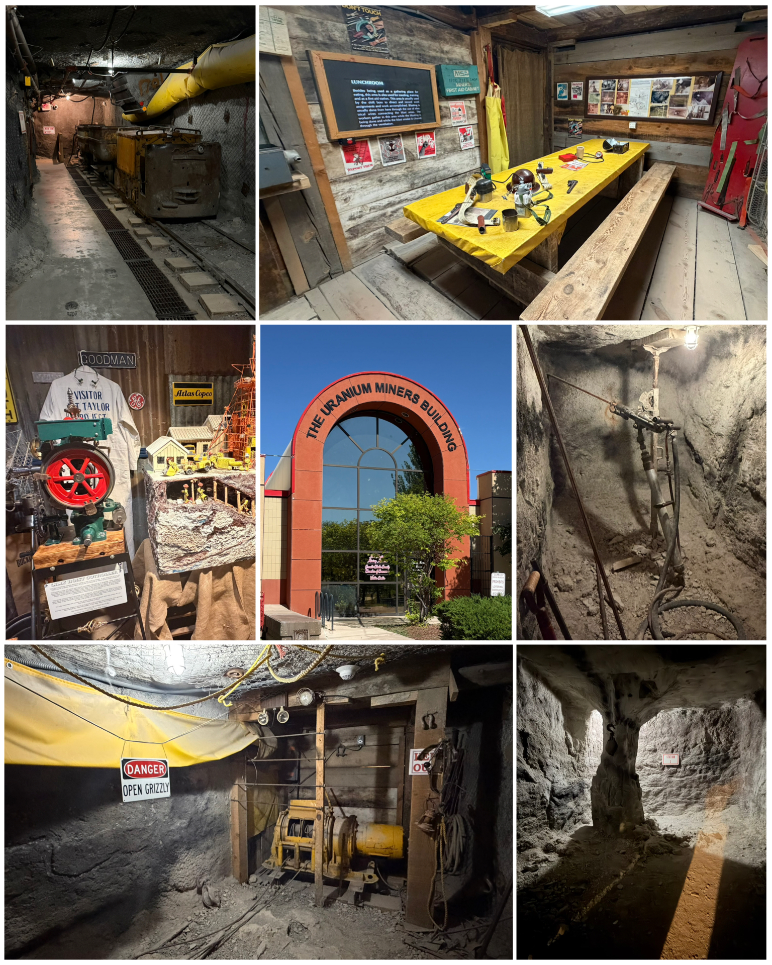 The following day we ventured into downtown Grants, where we would find some Rt 66 attractions, as well as a couple of museums. First up – the Uranium Miners Museum. Wow – was this place amazing! New Mexico has the second largest uranium ore reserves of any state in the United States. You entered into the museum via the visitor area where there were lots of different kinds of rocks and ores on display – mostly those native to the area. But the real fun begins when you take an elevator down below ground level to visit the perfectly recreated uranium mine. There were several stations with audio narratives that described the entire mining process. You’d swear that you were actually down in a mine! And according to the greeter that
 we had met upstairs, the recreated mine was actually built first, then the building above it was built thereafter. Very cool!
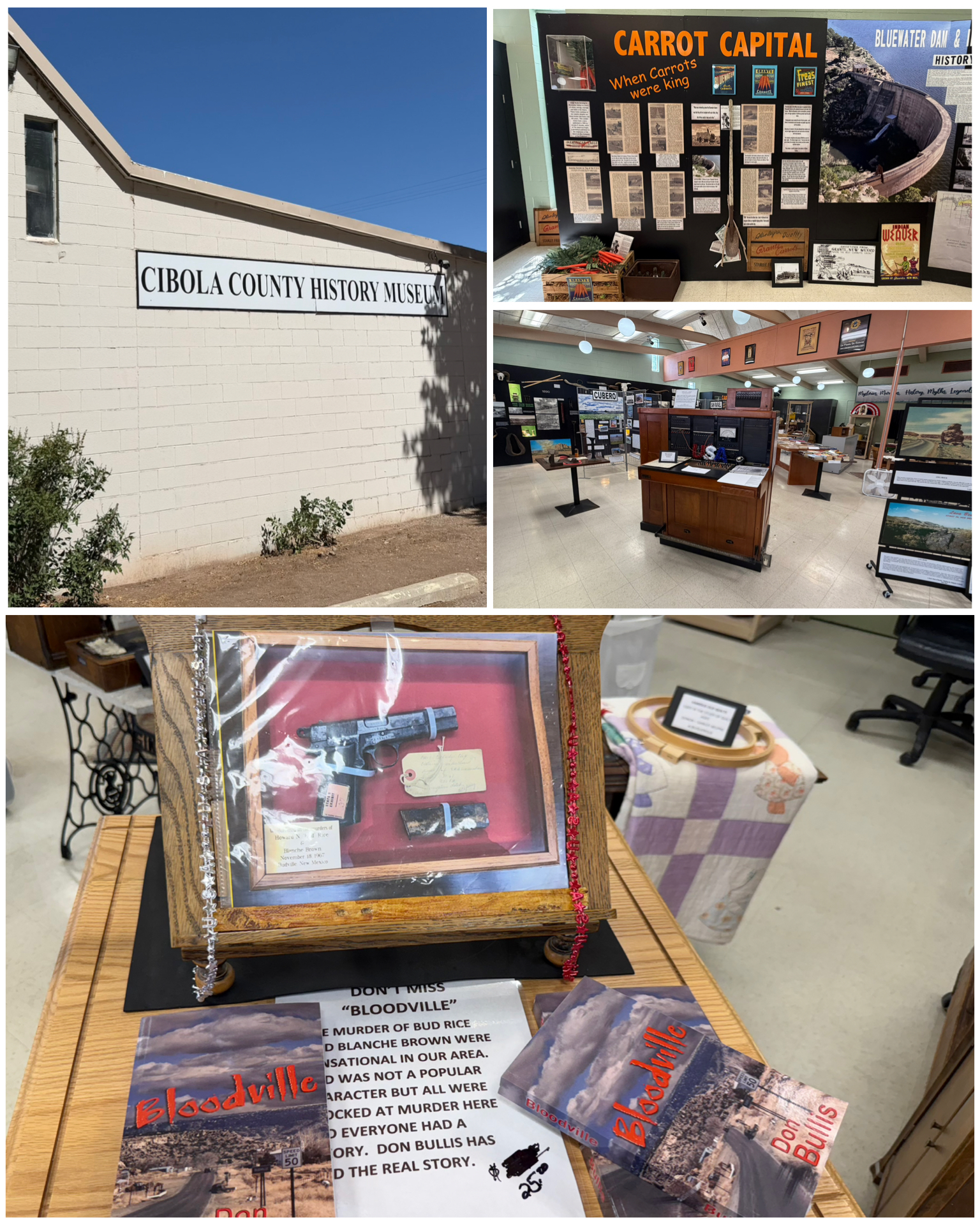
Next we visited the Cibola County History Museum that was right next door from the uranium museum. A really nicely done regional museum that told all about the local history. One of the fun facts that we learned was that the village of Milan and town of Grants was once the carrot capital of the world, and the day that they found uranium, it became the uranium capital of the world. It began in 1946 when a sheep farm was changed into an agriculture farm and the Carrot Capital was born. Grants shipped out over a thousand train cars full of carrots, peas, lettuce, etc. over the growing and harvesting season. The volcanic soil was rich for growing vegetables. It was later in the 1950s when uranium was discovered, and 75% of the water rights were transferred to mining activity, leaving only 25% for agriculture. It wasn’t long thereafter that the bottom fell out of the agriculture industry in favor of the mining. The other very interesting thing about the museum was its docent. The gentleman that pretty much gave us a private tour was not only extremely knowledgeable about the towns history, but it turned out that many of the artifacts contained in the museum had come from the various generations of his family. One of the more interesting displays was about the Budville (or Bloodville) murders, with the gun (actual or replica is unknown) along with copies of a book that was written about the town. My brother Dick went ahead and purchased a copy of the book – which I hope he passes on to me after he has read it. Very nice regional museum with lots of history.
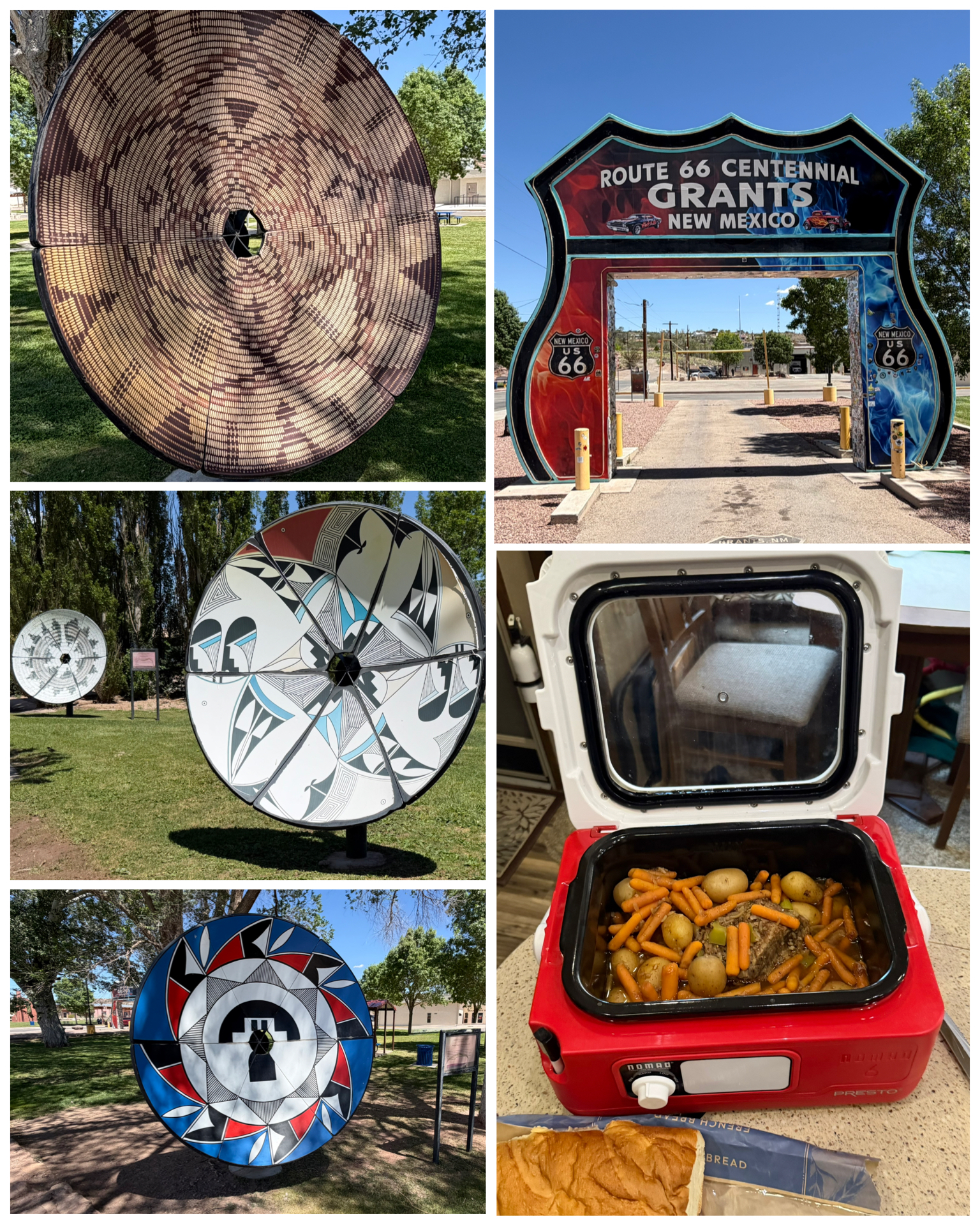 Next we wandered around town a bit to see some of its local charm. Here we found one of the four drive-thru Rt 66 shields that exist along the mother road – the other three being in Kingman and Holbrook Arizona, and Galena, KS. Again, my truck was way too dirty to be featured in a picture, so we just took a photo of the empty shield. The other interesting features of downtown Grants were these decorated satellite dishes. Known as the Native Basket Array, each Navajo native basket design is based on an original art piece from well established artists. This downtown art project was the brainchild of John Badal – former president of Qwest , a one time large technology and communications company. He apparently had many of these obsolete satellite dishes on hand, and wondered how they might be repurposed. He collaborated with the Cibola Arts Council and hatched an idea for an art installation – enlarge copies of Native basket designs, print them on vinyl, and turn six of the dishes into stand-alone artworks. Pretty cool idea! Before we headed out on our day trip through Grants, I put a roast in my crockpot to slow cook while we were gone. When we got back to the RV, a delicious meal was waiting. Yummy!
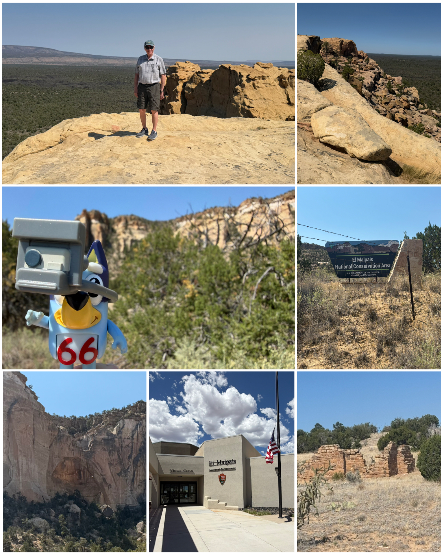 The following day we headed a bit south to visit the El Malpais National Monument. The name El Malpais is from the Spanish term Malpaís, meaning badlands, due to the extremely barren fields of lava flows, cinder cones, lava tubes, and other volcanic features, along with amazing sandstone bluffs. Due to the rugged lava landscape, there are no roads through El Malpais, but rather a couple of paved state highways that follow the eastern and northwestern borders of the monument. After stopping at the visitor center, we travelled further south on Rt 117 to check out a few of the monument’s features. First up was the old cottage (at left, bottom right). which are the remains of a 1930s homestead that once stood here. I can’t imagine anyone actually living out here! Next was the Sandstone Bluff Overlook (at left, top) which offered a dramatic and amazing view of the desolate surrounding area. Gotta watch out for those bluff edges as the drop down is pretty severe! Our final stop takes us to La Ventana Natural Arch (at left, bottom left). New Mexico’s second largest natural arch, it was formed by wind and water eroding away the softer parts of the sandstone cliff, leaving behind a spectacular arch tucked away in a small canyon. Its 135 feet long, 80 feet tall, and up to 25 feet thick at its narrowest point. Pretty amazing! Even Bluey got in on a bit of the action here at the National Monument.
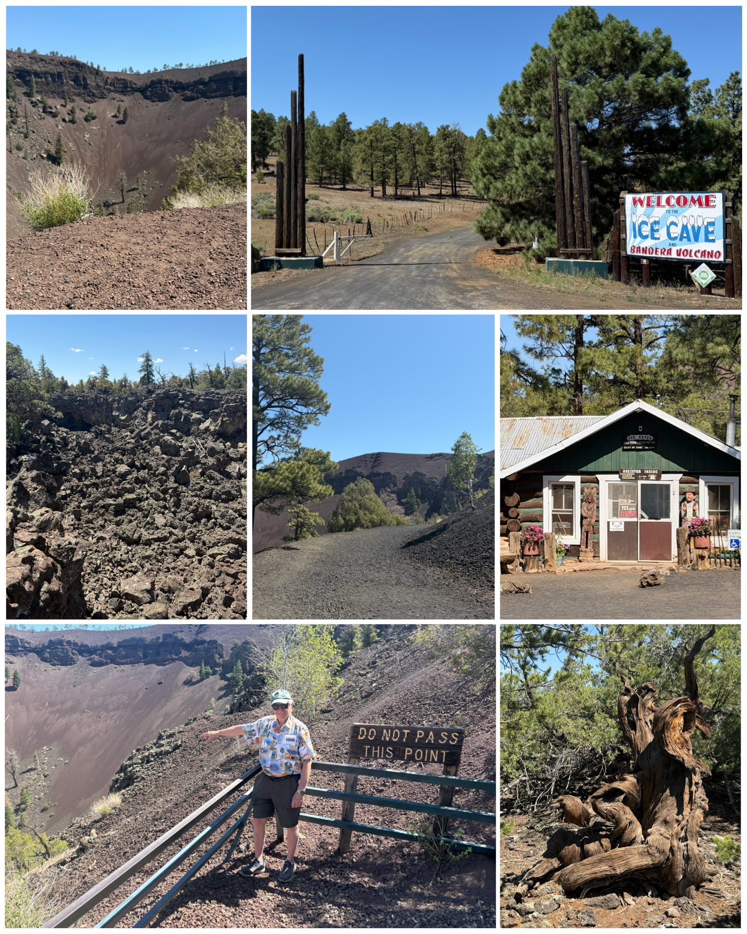 On Sunday, our final day in Grants, we headed out 25 miles to the southwest to visit a volcano and ice cave. Known as the Ice Cave and Bandera Volcano, this generationally owned and operated private tourist attraction features both the remnants of a volcano and a really cool ice cave. Getting to the volcano involved a half mile hike along a switchback trail, mostly uphill (at right, center) with a 200 foot elevation change, to eventually reach the viewing area. It is estimated that the Bandera exploded some 10,000 years ago, forming one of the best examples of an erupted cinder cone and lava field in North America. It spans 1,400 feet wide at its rim, and is 800 feet deep. Next, we hiked another half mile along a not so well made trail, viewing various
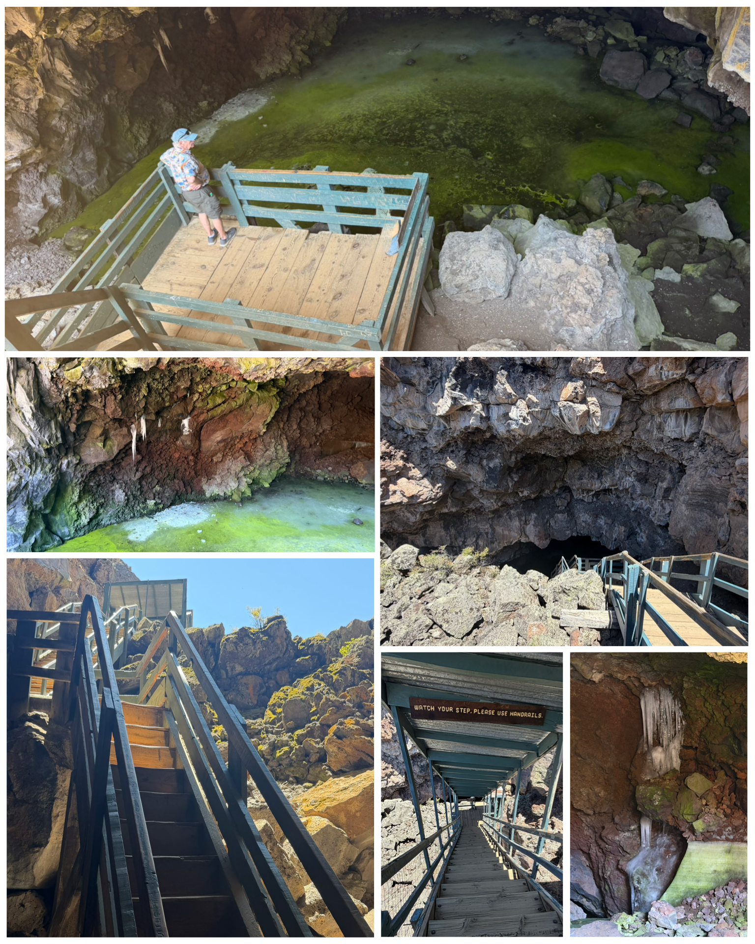 lava flows and tubes, along with twisted old-growth junipers (at right, bottom right). All of this to reach our next destination – the Ice Cave. The cave is located in a section of Bandera’s collapsed lava tube. Travelling down some 72 steps (at left, bottom center) along a not-so-perfect staircase, brings you to the coolness of the cave. That day’s outside temperature was well into the 90s on this day, while the cave offered a cool and crisp temp in the low 30s. In fact, it is said that the temperature in the cave never rises above 31 degrees the entire year. Layers of ice within the cave had been forming over the past 3,400 years. At one time back in the early days, the ice was even harvested out of the cave – which given the difficult and steep access, I can’t imagine the level of effort that would have been required to do so. That harvesting had significantly reduced the thickness of the ice wall, but now that this practice has long since been discontinued, the wall has started to recover. Standing on the observation platform was refreshing after having hiked to and from the volcano. But the break was soon over and the reality of having to hike back up those 72 stairs (at left, bottom left) became the next challenge. We kept it to a modest pace and eventually made it back out of the cave and back to the sweltering heat. A short quarter mile hike along a nicely done trail got us back to the entrance, and our ride back to the RV.
Albuquerque, NM
The next day, Monday, was a travel day – taking us out of Grants to the big town of Albuquerque. We were actually supposed to travel on Tuesday, but I shortened our stay in Grants, and added the extra day in ABQ to give us a day to explore ABQ before Dick’s scheduled return to NH departure on Wednesday. Specifically, I scheduled us for an afternoon Amazon Fulfillment Center tour on Tuesday. We somehow got on the subject of these tours – something that I had done a few years prior. Dick had never been in an Amazon center before, and when I looked and saw that there was a center in ABQ, and tours were available for Tuesday, I went ahead and made the travel changes and booked the tour.
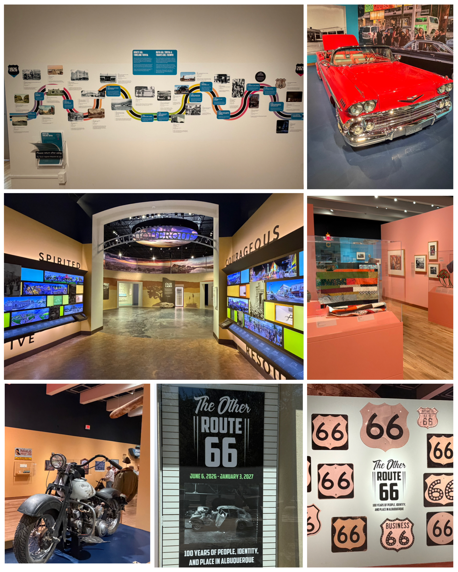 So, we had the Amazon tour booked for the afternoon, and needed something to fill in the morning. There were obvious Rt 66 attractions to visit, as well as several area museums. We settled on visiting the Albuquerque Museum, since neither Dick or I had been there before, and it also featured a limited run centennial Rt 66 exhibit titled “The Other Route 66 – 100 Years of People, Idnetity and Place in Albuquerque”. It was a very large museum with 6 or 7 different exhibit rooms – each featuring different art, or history related to ABQ. The Rt 66 exhibit was well done and featured lots of Rt 66 artifacts – including several historical road signs, classic car and motorcycle, and an ABQ specific 100 year Rt 66 timeline (at left, top left). The rest of the museum will filled with various pieces of art – including representation from the Native American community. Some of the art was particularly abstract, or in some cases, simple blotches of paint
 that a 5 yr old could seemingly recreate. Ah, once again as they say, art is in the eye of the beholder.
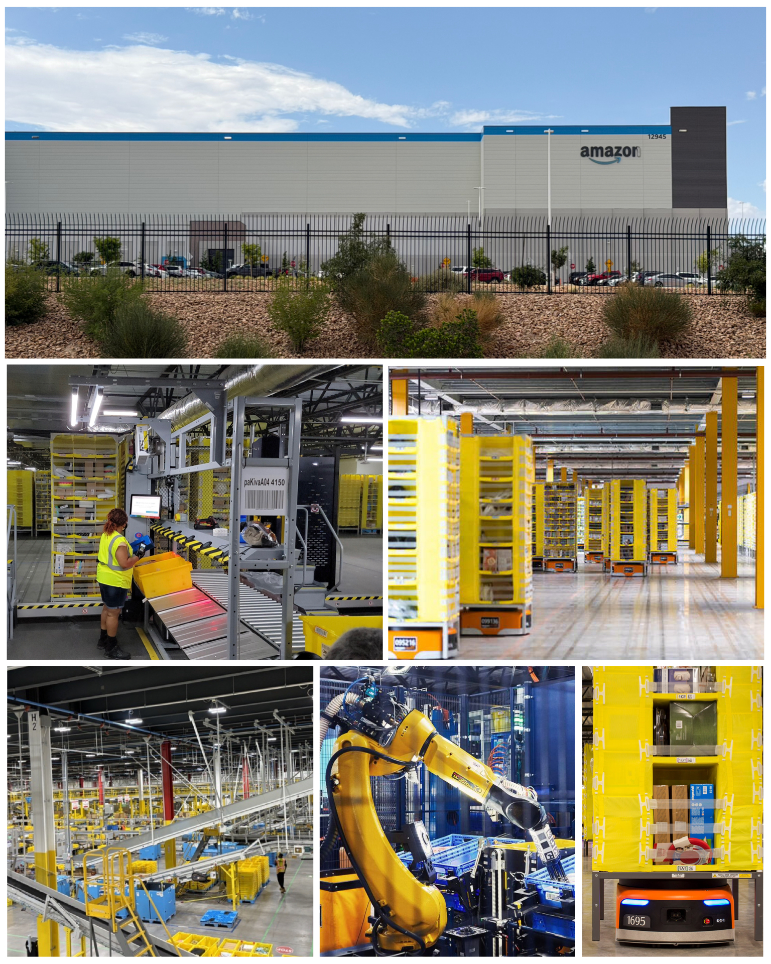
So after the museum, we headed on over to the Amazon Fulfillment Center just a few miles away. Tours happen several days a week, with both a morning and afternoon session. Each session has a maximum capacity of 25 people. At the time I had signed up for this session a few days prior, Dick and I were the only two scheduled. As it turned out, there were no others that signed up so we pretty much got a private tour. Wahoo! So we arrive, get checked in by security, and proceed to a small conference room where we are given an overview of the tour along with a list of do’s and don’ts. One of the thou shall not rules was that no recordings of any form were allowed. No pictures, no video or audio recording. But, they had no restrictions of me finding someone else’s pictures of the inside that were posted on the Internet. So, to make this story a bit more interesting, I hijacked a few of those pictures here at right. It was an amazing tour and clearly showcases the level of technology and automation that Amazon has employed to gain maximum efficiency in all their product receipt, storage, and ultimate sale and distribution. This was a 4 story 2.5 million sq feet building with the lower floor used for operations where people are, while the upper three floors are storage only with thousands of the pods that contain sellable product. The pods are picked up and moved around by robots (at right, center and bottom right). So no longer are people running around a warehouse of products packing or picking items. Rather, robots bring the pods to the people as needed (at right, center left). A vast conveyor system (at right, bottom left), that if it were placed end-to-end, reportedly stretches out some 13 miles, is used to move stuff all throughout the various processing zones. Robot arms (at right, bottom center), with a suction cup pickup end, are also used used to organize and move product according to some specified criteria (usually shipping destination). The process, while highly automated and efficient, isn’t without its flaws. Dick and I witnessed one particular machine that places shipping labels on packages not doing such a good job with the envelope style shipping containers. The labels were half on/ half off, and on several occasions, even totally missed the package all together and ended up on the ground. But overall, a truly amazing operation to see in person, and one that I highly encourage anyone to take. Details of tour locations and signup can be found HERE.
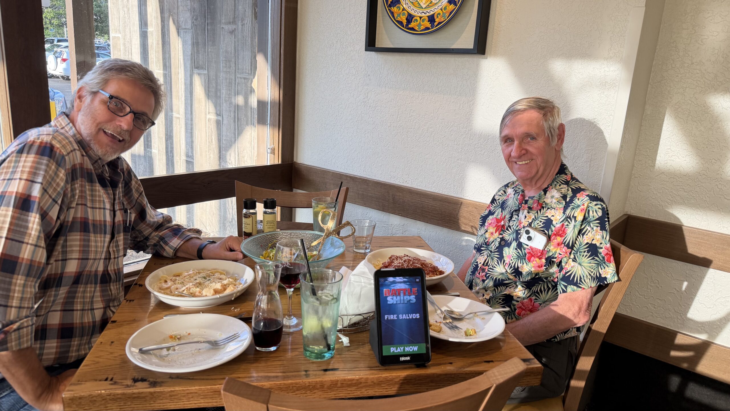 After the tour, it was time for a final end of visit italian dinner. My brother’s two-weeks of travel with me had come to an end. The next morning, we had to get up at 4:45 am in order to get him to the airport for a 7:00 am flight. Geez – sure wish he could have scheduled a later flight! I’m retired and usually sleeping in – and have not been conscious that early in the morning in quite a while! But anyway, it was great traveling and exploring with him over these past couple of weeks, and I hope he enjoyed it as well. I will now resume my travels as a solo inhabitant, continuing my regularly scheduled trek along the remaining stretch of Rt 66.
Final Thoughts
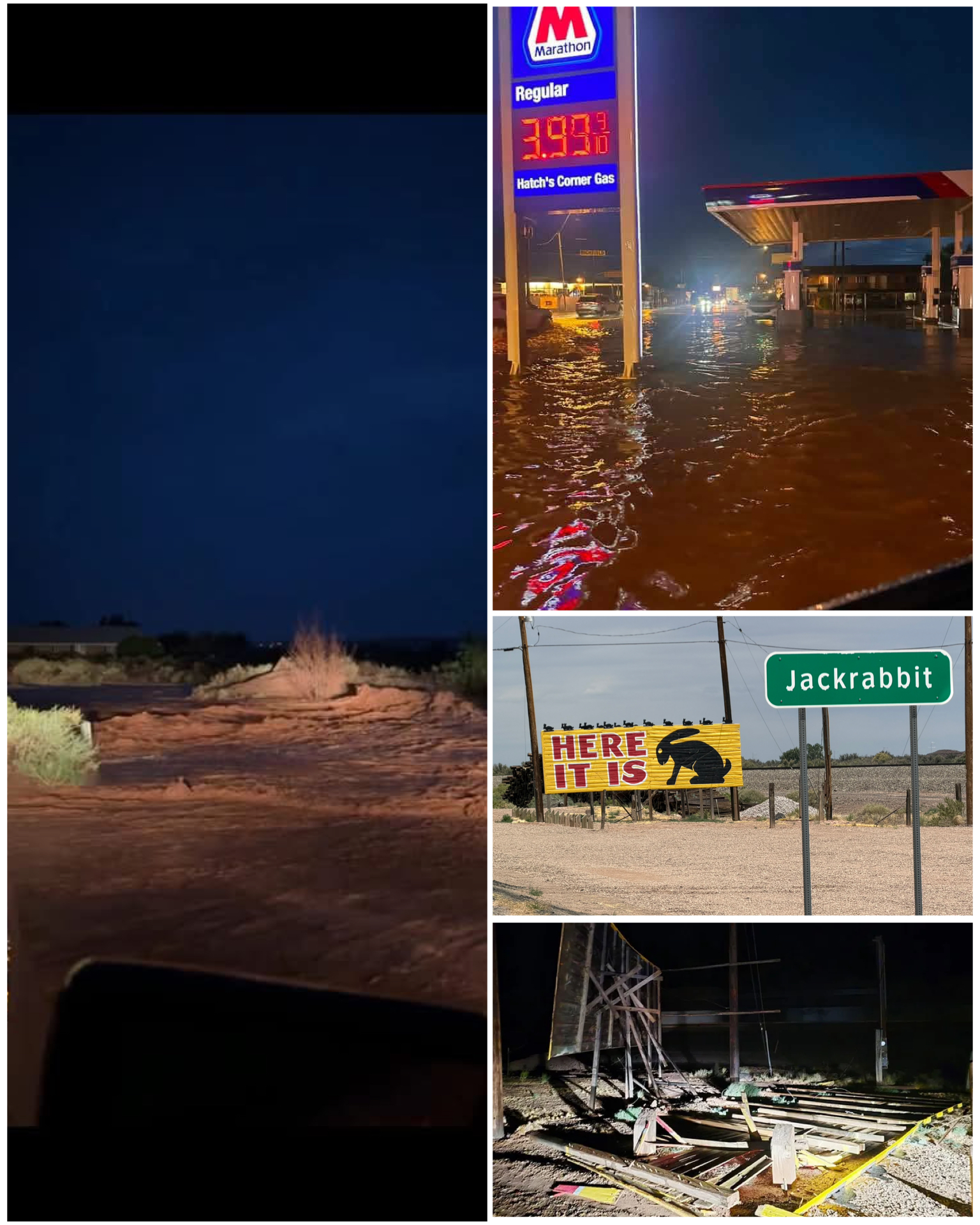 Ok – I’ll end things here as this blog has already gotten quite long. I did want to send my prayers to the residents of Holbrook, Gallop, and surrounding area. A couple of weeks after we had left those towns, a series of ferocious monsoons came through the area turning streets into rivers as the downtown was flooded. Back at the Jackrabbit Trading Post, a place we had been just a couple weeks prior and where I took this picture of the sign (at right, center right) – well the sign is no longer. It was blown apart by strong monsoon winds (at right, bottom right). I know this is monsoon season for these areas of the southwest, and so far I have not had to experience them firsthand. It is certainly eye-opening, however, to see just how close I came to having been in the middle of some. Definitely thankful that I was not! I’ve completed roughly 811 miles of the 2,448 totality of Rt 66, so now I’ll continue making my way along the route through the rest of NM, TX, OK, KS, MO and IL. Still so much to see and explore, and I’ve got another nine weeks left to go in my journey. so until next time, be well and safe travels.
I only show a sampling of my adventure pictures here in the blog, and do so mostly in collage format for brevity and ease of reading. If you want to view an album containing individual full fidelity and hi-res images of all my travel pictures related to this specific blog, click the image below. Enjoy!
I got a chance to visit the Amazon facility in Baltimore a couple of years ago. Wow! what
a monument to automation. I’m sure the whole AI technology thing has had a big effect
on the one you visited.
Rick
Yea, I had visited one in KY a few years back. Even since then, I got to see some new tech with this visit. I can’t imagine what it’s gonna be like in another 10 years!
As always a great blog post, however made much better because I was part of it. I had a great time with you and now wish I had planned a month instead of 2 weeks. Actually better than that would have been being along for the entire Rt 66 trip and relive my trip back in 2014. Enjoy the rest of your trip and I will relive it via your blog.
Glad you could tag along and had a good time. I too enjoyed traveling with you. But I do think 2 weeks was just the right length! 😁
As always such an interesting blog, Bruce. I enjoyed the part about the code talkers in WWII. I had a US history teacher in high school who was a former marine and I remember him doing a few days lessons on the code talkers. If memory serves their operation was declassified a few years before my junior year (1972), i believe in the late ’60’s and this teacher was fascinated with it. Interesting stuff.
The Amazon facility was cool too. Will have to see if we can tour our local one.
Safe travels as you go forward. How’s your truck?
Yea, the code talkers were definitely interesting! I don’t have as good a memory as you when it comes to high school history. But I do recall that my interest in history back then was pretty much non existent in favor of things related to technology (figures!), so they may have covered this then and I simply didn’t pay attention. So glad that I’ve since developed a better appreciation and interest in history in my later years. As for the truck, too much to explain here, so it will have to wait until the next blog.
Lots of cool things to see once again. Good thing Dick was with you since it doubled the crowds at all the sites. Enjoy your continued journeys, looking forward to learning a little more.
Yup, I’m still in shock about the lack of people we are running into out here on Rt 66, and in the campgrounds. But, like our Amazon tour, we get the whole place to ourselves. Still feel bad for all the vendors and campground owners though.